History
The name “Sandy Hook” was created when sand was placed on the waterfront to make the area more attractive. The neighbourhood of Sandy Hook began as a group of small summer cottages. These homes were originally water-access only. They were further developed in 1960-1970’s as residential subdivisions. The area is still characterized by small “cottage” homes, but also large ocean-facing homes, and quiet rural winding roads.
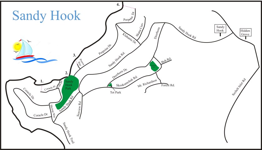
Beach Access
1. Fish Tail – Easy access beach. Fish Tail is off Coracle Place near Sandy Hook Park. A gently sloping path leads to a small spit with a picnic area.
2. Sandy Hook Park – 6009 Ark Road (Ark and Coracle Drive) This 1.9 hectares beach access park has it all. A sandy swimming beach, a children’s playground, picnic areas, benches, doggie bag dispensers, garbage cans, a boat launch, great seasonal views and a seasonal port-a-potty.
3. Prawn Way– This is our most challenging and difficult access. Use caution on the very steep, narrow and long set of stairs and pathway.
4. Porpoise Drive – Switchback down a very steep trail to a secluded sandy beach at the mouth of Davis Brook. It is peaceful and affords great swimming.
Landscape
Sandy Hook is largely hilly. People refer to their homes being on the “uphill” or “downhill” side of the street when giving directions. Most lots offer ocean views and the area is surrounded by upland forest. An ice sheet once covered the entire Sunshine Coast carving out its current topography. There is a shallow overburden of sedimentary soils on top of the igneous bedrock. True to its name the soil is sandy.
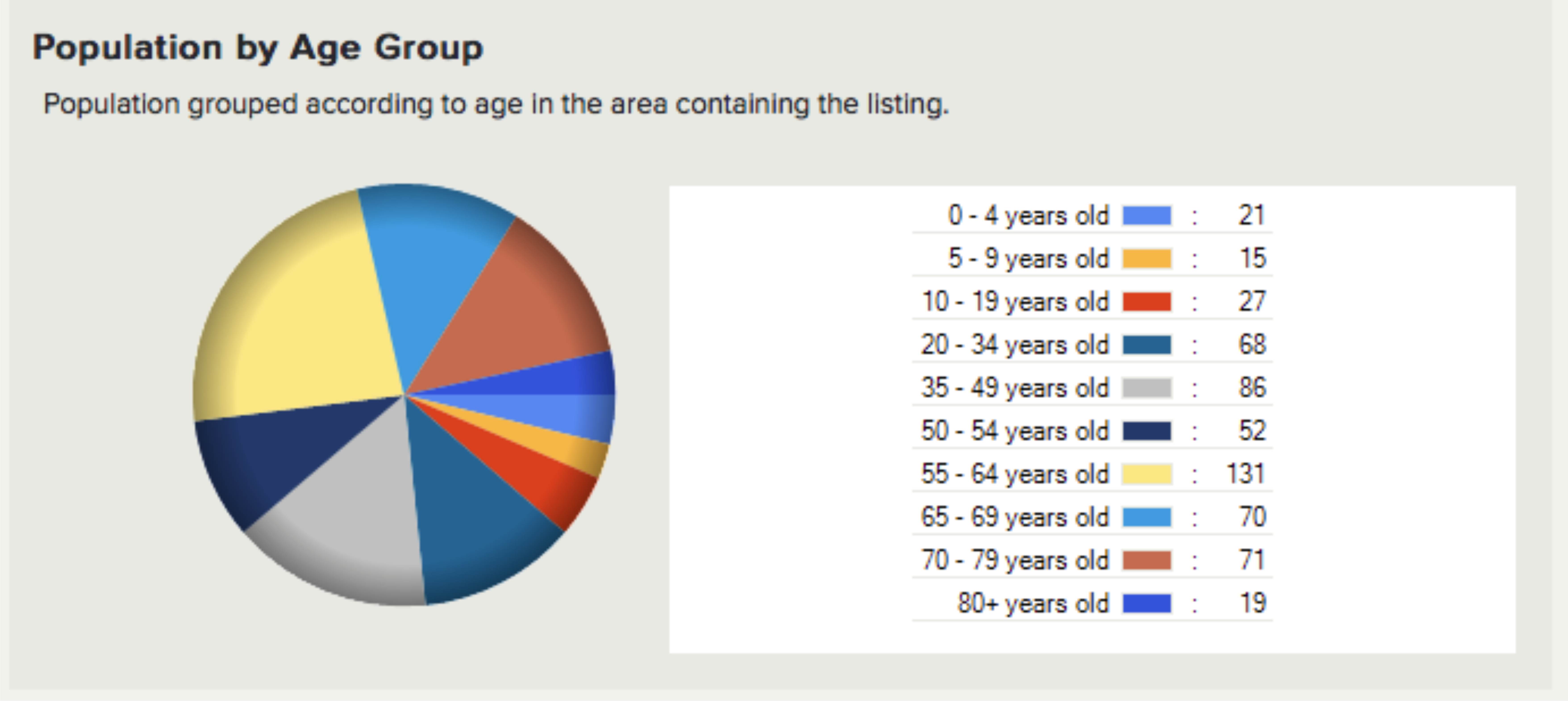
Demographics
There are approximately 640 permanent residents in Sandy Hook and 200 seasonal residents in approximately 240 homes. 3/4 of the available lots have been developed. The neighbourhood hosts several B&B’s as well as vacation and year-long rentals.